Esri releases subscription-based GIS for Power BI

Esri has introduced Plus, a subscription option of its ArcGIS Maps global information system (GIS) for Power BI. This capability, first announced at Microsoft Ignite 2017, is now available in Power BI Desktop and the Power BI service.
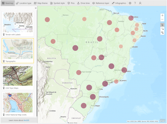
As Microsoft describes on its Power BI blog, Plus enables everyday business users in Power BI to do more with their spatial data. Plus offers improvements over the existing ArcGIS Maps integration with Power BI, with more basemaps; data points; demographics, and reference layers, all aimed at making GIS easier to understand and consume those business users.
For $5 per user per month, the Plus subscription enables users to:
- Access global demographics
- Access verified ready-to-use data, curated from authoritative sources
- Map and view more locations, up to 5,000 address geocodes per map instance, and up to 1 million per user per month
- Access 12 basemaps, such as satellite imagery, oceans, and terrain, to create visualizations that give perspective and impact decisions
- Conduct the same spatial analyses as Included with ArcGIS Maps for Power BI
According to Power BI Senior Program Manager Lukasz Pawlowski, business users have said they want to geocode many street addresses. While it makes sense to incorporate pre-geocoded data into users' datasets for speed and predictability at some point, Plus will let users geocode more street address data points on the go. This enables users to push mapping even further than previously possible with ArcGIS Maps for Power BI, Pawlowski stated.
An important aspect ...
FREE Membership Required to View Full Content:
Joining MSDynamicsWorld.com gives you free, unlimited access to news, analysis, white papers, case studies, product brochures, and more. You can also receive periodic email newsletters with the latest relevant articles and content updates.
Learn more about us here