How Dynamics 365 Maps Help EV Charging Teams Keep Networks Running
Electric vehicles are no longer a niche. As more drivers switch, charging networks are growing across cities, highways, workplaces, and apartment complexes. Behind every working charger is a field team that installed it, inspects it, and fixes it when something goes wrong.
That is a lot of ground to cover. A faulty unit can leave drivers stranded, and every extra mile a technician drives is time not spent on repairs. For companies that manage charging networks in Microsoft Dynamics 365, the question is simple. How do you keep hundreds of sites running with a field team that cannot be everywhere at once?
A map is a good place to start. Maplytics, a certified geo-analytical solution for Dynamics 365 and Dataverse, puts supported location records on an interactive map inside the CRM. Here is how that helps in the EV charging industry.
Key Takeaways
- EV charging networks are field operations challenges, with many sites and a field team that can’t be everywhere at once.
- A map shows what a list of addresses can’t: which sites are close together and where technicians are thin.
- Route Optimization lets users plot multiple waypoints, optimize by travel time or distance, and follow turn-by-turn navigation. It also supports truck routing with vehicle-specific parameters.
- Proximity or Radius Search narrows urgent fault calls to what’s nearby, and Along the Route search finds records on the way to a destination.
- Territory Management shows coverage overlaps and gaps, and draft territories let managers test a realignment before it goes live.
- Heat Maps show where sites, faults, or opportunities cluster, helping teams decide where more technicians may be needed.
- Auto Scheduling builds optimized schedules across multiple days and users, Real-Time Tracking shows tracked field representatives, and MapCopilot answers plain-language prompts.
- Maplytics supports geographic planning and field operations. It does not replace a charging network management platform.
Why EV Charging Is a Field Operations Challenge
A charging network is dozens or hundreds of sites, each with its own address, host, hardware, and service history. If those records sit in Dynamics 365 as rows of addresses, nobody sees the whole picture. Which sites are close together? Which regions have too few technicians? A list cannot answer those questions. A map can.
1. Route Optimization for Installation and Maintenance Visits
Picture a technician with eight stops in a day, a mix of inspections and one fault repair. Visiting them in the order they appear on the job list can mean crossing the same part of town several times.
Maplytics Route Optimization lets users plot multiple waypoints, optimize the route by travel time or distance, and follow turn-by-turn navigation. It also supports truck routing with vehicle-specific parameters, which can matter for crews carrying heavy equipment to a new site.
The result is less backtracking and more time at each charger. Optimized routes cannot guarantee every job finishes on time, since repairs can run long, but they remove avoidable travel waste.
2. Proximity Search for Urgent Fault Calls
A charger goes offline on a busy afternoon. The operations team needs to know what is close, and fast.
Proximity or Radius Search lets users set a distance or travel-time range around the faulty site and see which mapped records fall inside it, such as nearby field resources or other charger sites to check on the same trip. Instead of scanning a long list, the team narrows the search to what is actually nearby.
Maplytics also offers an Along the Route search that finds relevant records along the route to a destination. A technician heading to one repair can spot another site in need of inspection a few minutes off the route and handle both in one trip.
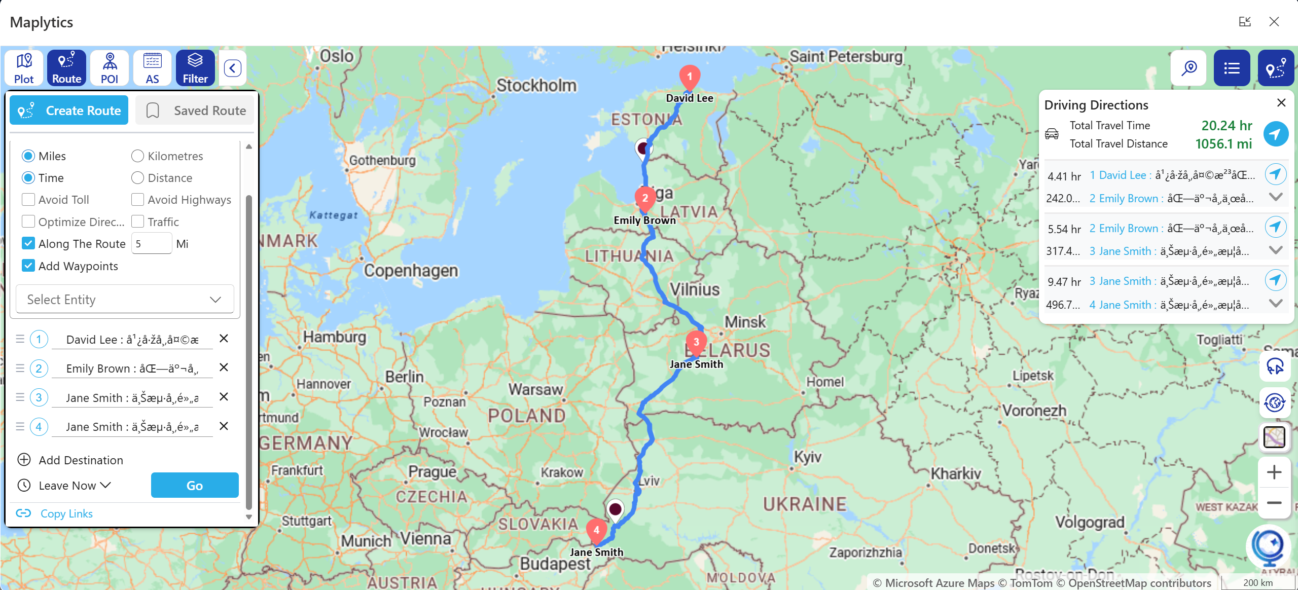
These searches work on records stored in Dynamics 365. Whether a technician is free, qualified, or carrying the right part still depends on your scheduling and inventory systems.
3. Territory Management for Growing Networks
As a network expands, the old way of dividing work stops fitting. A region that once needed one technician may now need three, and two account managers may be calling on the same property group without knowing it.
Maplytics Territory Management lets managers create, visualize, align, and manage territories on the map. They can see where coverage overlaps, where it is thin, and how new sites fit the existing layout. Draft territories let managers test a realignment before it goes live, which helps when the network enters a new city.
A map does not balance workloads by itself. Managers still need to weigh site counts, technician availability, and service priorities. What the map provides is a clear geographic starting point.
4. Heat Maps to Show Where Activity Clusters
Maplytics Heat Maps visualize the concentration of mapped records using supported measures. A team with site, fault, or opportunity records in Dynamics 365 can see where they cluster and decide which regions may need more technicians. Heat maps do not predict demand on their own, but they help teams read the location data they already hold.
5. Scheduling, Tracking, and Plain-Language Questions
Field work in this industry runs on calendars. Inspections are booked, installations are scheduled, and urgent repairs interrupt both.
Maplytics Auto Scheduling can build optimized schedules across multiple days and users, taking location, configured preferences, and existing appointments into account. Real-Time Tracking shows managers the locations and travel history of tracked field representatives, which helps during a busy day or an urgent call. For managers who would rather type a question than click through filters, MapCopilot, the AI assistant, can plot records, run proximity searches, and optimize routes from natural-language prompts.
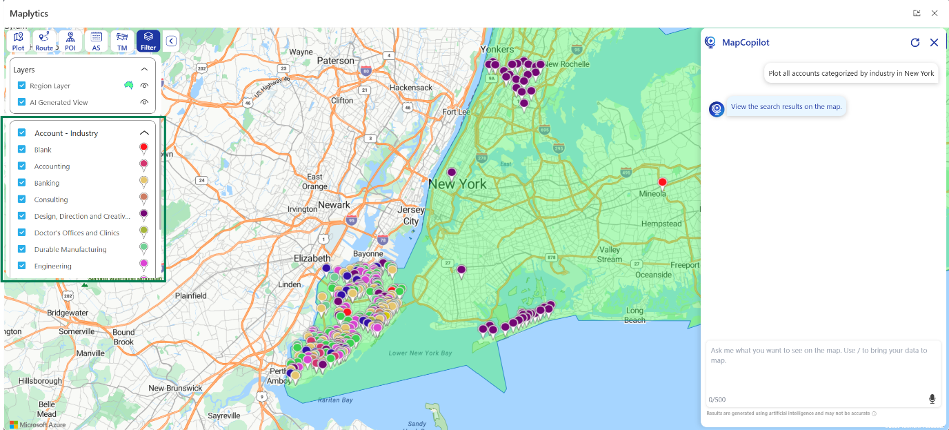
Tracking a technician is not the same as monitoring a charger. Live charger status, error codes, and uptime come from the charging management platform, not from Maplytics. The two work best side by side.
What to Check Before You Start
- Address quality. Make sure site records in Dynamics 365 have usable location data.
- Record structure. Confirm that sites, technicians, and customers are stored as records Maplytics can plot.
- Territory logic. Decide how regions should be divided before drawing them.
Maplytics supports geographic planning and field operations. It does not replace a charging network management platform.
Keep the Network Moving
Every charger that works is a driver who gets home and a fleet that stays on schedule. The teams behind those chargers cannot control every fault, but they can control how well they plan routes, cover territories, and respond when something breaks.
FAQs
1. How do Dynamics 365 maps help EV charging teams?
They put site, technician, and customer records on an interactive map inside Dynamics 365. Teams can see which sites are close together, where coverage is thin, and where to send technicians.
2. How does route optimization help EV charging technicians?
Users can plot multiple waypoints, optimize by travel time or distance, and follow turn-by-turn navigation. This reduces backtracking so technicians spend more time at each charger.
3. Can Maplytics plan routes for crews carrying heavy equipment?
Yes. Route Optimization supports truck routing with vehicle-specific parameters, which can matter for crews carrying heavy equipment to a new site.
4. How does proximity search help with urgent charger faults?
Teams set a distance or travel-time range around the faulty site and see which mapped records fall inside it, such as nearby field resources or other charger sites to check on the same trip.
5. What is Along the Route search?
It finds relevant records on the way to a destination. A technician heading to one repair can spot another site needing inspection a few minutes off the route and handle both in one trip.
6. How does territory management help as a charging network grows?
Managers can create, visualize, align, and manage territories on the map, and see where coverage overlaps or is thin. Draft territories let them test a realignment before it goes live, such as when the network enters a new city.
7. What do heat maps show for EV charging operations?
Heat maps visualize the concentration of mapped records, such as sites, faults, or opportunities. They help teams see where activity clusters, but they don’t predict demand on their own.
8. What do Auto Scheduling, Real-Time Tracking, and MapCopilot do?
Auto Scheduling builds optimized schedules across multiple days and users, using location, configured preferences, and existing appointments. Real-Time Tracking shows locations and travel history of tracked field representatives. MapCopilot plots records, runs proximity searches, and optimizes routes from natural-language prompts.
9. Does Maplytics show live charger status or uptime?
No. Live charger status, error codes, and uptime come from your charging management platform. Maplytics supports geographic planning and field operations, and the two work best side by side.
10. What should I check before getting started?
Make sure site records have usable location data, confirm that sites, technicians, and customers are stored as records Maplytics can plot, and decide how regions should be divided before drawing territories.
What’s More?
Maplytics, with its AI assistant, MapCopilot, adapts to the shape of your business. Whether your mapping needs run on Bing Maps, Azure Maps, Google Maps, Apple Maps, or ESRI ArcGIS, Maplytics makes the integration inside Dynamics 365 feel seamless, from Radius Search and Route Mapping to Territory Management and Heat Map analysis, etc. To experience it first-hand, you can have a 15-day free trial or get a personalised demo inside Microsoft Dynamics 365 CRM, Power Apps, Power Pages, or Dataverse. Get in touch at [email protected], or explore more at the Website and Microsoft Marketplace.